
Hiking in Malaga is becoming one of the most popular activities and more and more people are launching to explore Malaga and the province through its nature. These hiking trails in Malaga allow us to discover new places in Malaga capital and province or explore other areas out of the ordinary.
It also offers the option of walking through nature with family, friends or alone in case you need a little disconnection, even looking for new adventures, for those who demand stronger emotions.
In this list of 15 hiking routes in Malaga and province you I present routes through Malaga capital, ideal to do as a family or in a group and hiking trails through the province of Malaga of different difficulty: easy, medium and difficult.
When to go hiking in Malaga? The best time.
In Malaga we have a fantastic weather, with more than 300 days of sunshine a year, however summer has high temperatures, so it would really be the The least recommended time to go hiking in Malaga (besides, the comparison with the beach is inevitable).
The best times to go hiking in Malaga are autumn and spring, even the first months of winter.
More specifically, September to November are ideal months for hiking in Malaga. Then, from March to June, we have 4 perfect months for walking, also with more daylight hours to tackle longer routes.
How do I choose the most appropriate hiking route through Malaga?
The first thing is to check the difficulty and length for which I have classified each route into three levels: easy, medium and difficult. I have also included the details of each one, the best time to do it and its location.
Hiking through the province of Malaga is a perfect way to get to know towns (Alhaurín de la Torre, Pizarra, Mijas, Álora or Nerja), mountains and natural landscapes, which we would not have done otherwise.
This selection of hiking routes is a personal choice, based on my experience in each of them. We will be expanding it with other routes such as the climb to Pico Torrecilla, the Arab staircase, the Saltillo bridge or the climb to Maroma.
5 easy level hiking trails in Malaga capital.
These hiking routes are ideal for families, groups or beginners, with all the starting points being about 30-40 minutes from the center of Malaga.
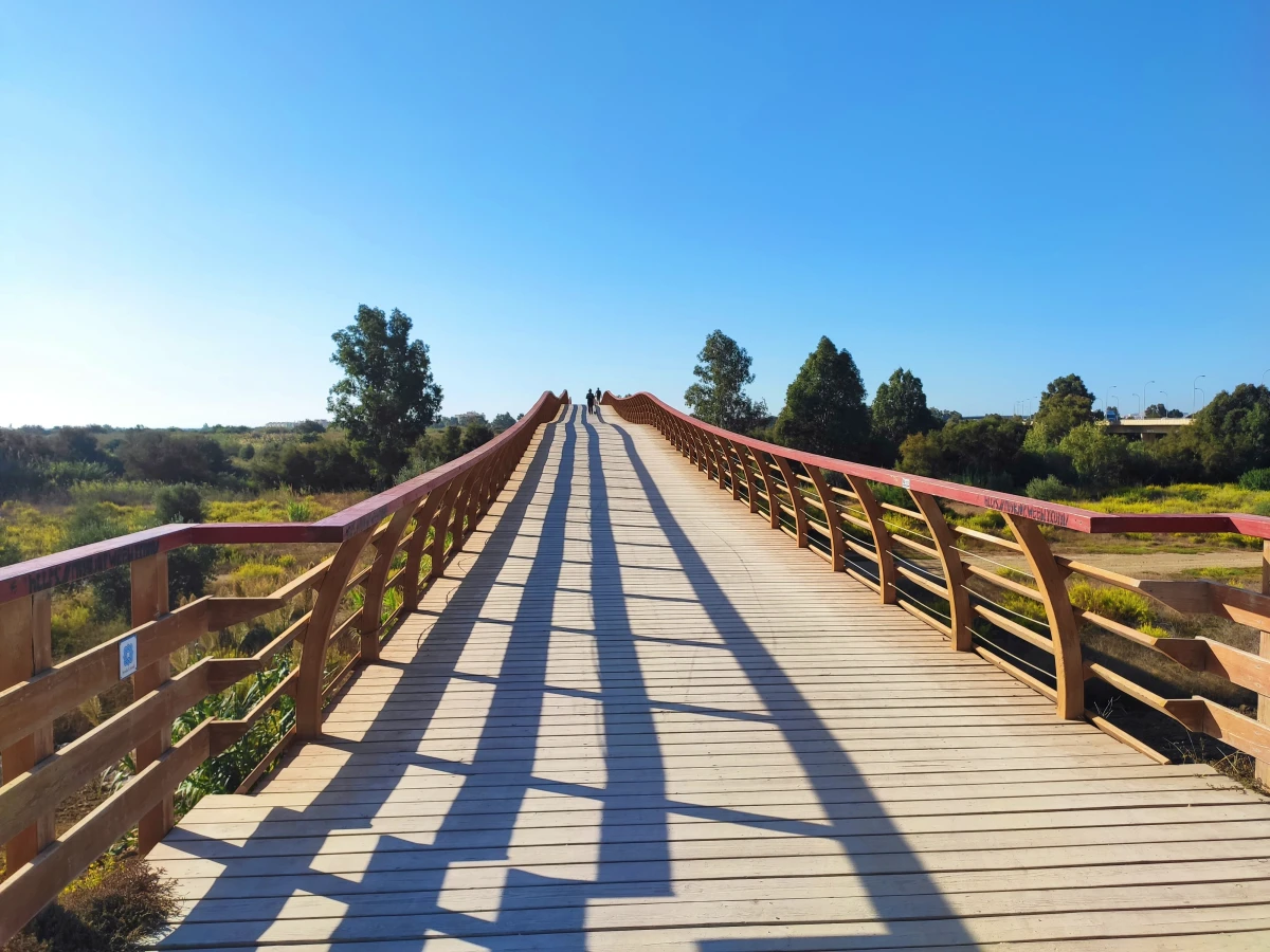
Guadalhorce.
The Guadalhorce route has become one of the most popular hiking routes in Malaga. A simple route, without unevenness and suitable for all audiences.
We will walk the two trails of the natural area: the Río Viejo and the large lagoon, with access to 7 bird observatories on the route.
Data on the route of the Guadalhorce.
- Google Maps start point: Guadalhorce footbridge
- Distance: 9.36 km.
- Time spent: 2 hours (1h 47 min active + 13 min rest).
- Ideal time: October to May.
Venta el Boticario.
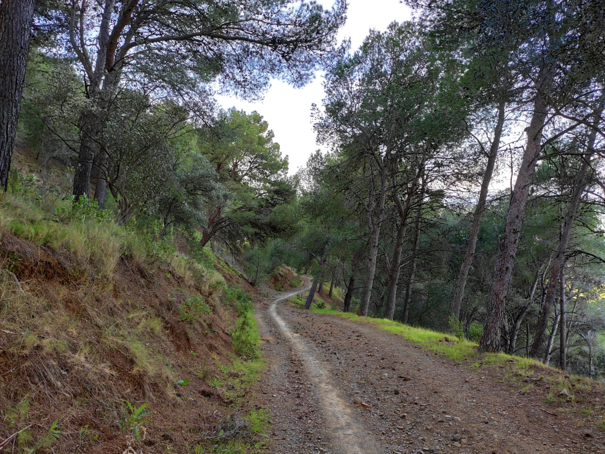
A circular route through the Montes de Malaga, simple and comfortable for the whole family, starting at the well-known Venta El Boticario.
One of the great advantages of this trail is that the path is dirt, with some stones, a perfect forest path for walking and also very easy to follow.
Unlike other routes through the Montes de Málaga, this route hardly has viewpoints or views of the city, but it is great for contact with nature.
Data on the circular route through the Montes de Malaga.
- Google Maps start point: Sendero el Boticario Parking.
- Distance: 8.5 km.
- Unevenness going up/down: 266 meters.
- Duration: 2h.
- Ideal time: all year round.
San Telmo Aqueduct
This hiking route through Malaga will take you to see the San Telmo aqueduct, both in its historical part and in the restored area, being one of the most beautiful walks we have in the capital. In addition, it is simple and perfect to do in a group or with the family.
I have created a circular route, of 7.5 kilometers, that we have designed and that seems to us the most interesting due to its length and layout.< /p>
Data on the San Telmo aqueduct trail.
- Start point on Google Maps.
- Distance: 7.5 km
- Time: 2h 30 min.
- Ideal time: all year round, except summer.
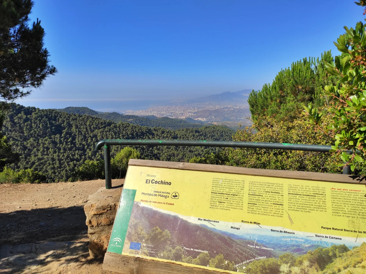
Mirador del Cochino al Vazquez Sell.
This is another circular route through the Mountains of Malaga, ideal for the family and for a first foray into the area. It is of easy difficulty and also offers excellent panoramic views
The detour to the Fuente de la Reina is the same one we took on the route to the Mirador de Pocopán, which is located just 4 kilometers from the Vázquez Sell viewpoint.
Data on the circular route from Cochino to Vazquez Sell.
- Google Maps starting point: Cerrado Recreation Area
- Distance: 6.81 km.
- Time spent: 2 hours (1h 41 min active + 20 min rest).
- Ideal time: September-October and April to June.
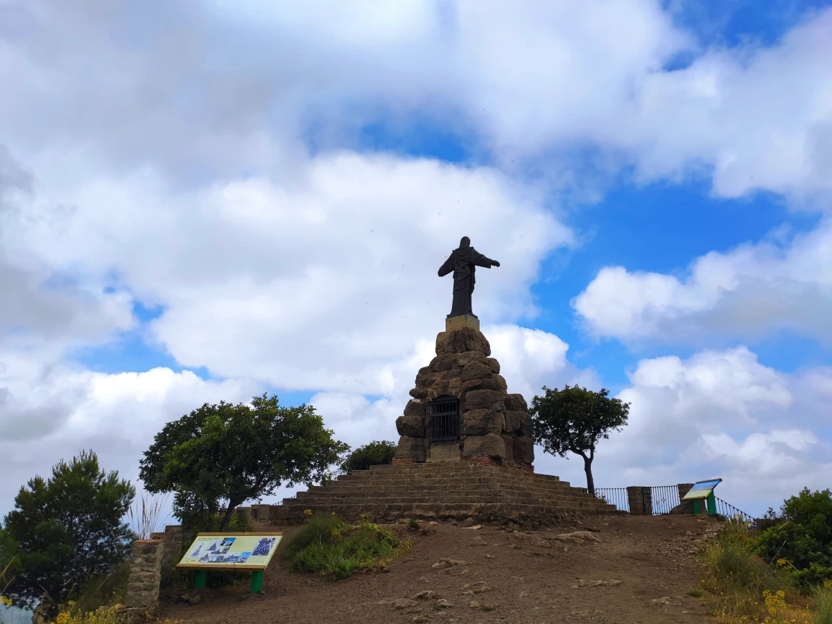
Monte Coronado
The climb to Monte Coronado in Malaga is one of the easiest and most accessible hiking routes in Malaga.
Furthermore, as with the Mount Victoria or Mount Tortuga, it is just a few minutes from anywhere in the city and offers a fantastic view of the entire city of Malaga.
Data from the climb to Monte Coronado.
- Start point on Google Maps: “Start of the ascent to Monte Coronado”
- Address: Calle Eresma, 1 Málaga.
- Distance: 3.71 km.
- Maximum altitude: 225 meters
- Time spent: 1h 26min (1h min active + 25 min rest).
- Ideal time: October-May.
5 intermediate level hiking trails in Malaga province.
These hiking routes through the province of Malaga offer us some challenges, either due to length, unevenness or the journey to the starting point.
These are not overly complex routes, but they do require good physical shape.
Ascent to the Saint of Pizarra.
The climb to Santo de Pizarra is perfect in terms of length (6-7 km.), hardness (easy -medium), proximity to the capital (25 km.) and reward at the top (fantastic views of the Guadalhorce valley and the surrounding mountains), located 450 meters high.
In addition, the route is perfectly signposted and the area is ideal for spending a picnic, if what we are looking for is just to take a short walk through nature.
We can make the route circulate if we continue from El Santo towards the Hermitage of Ntra. Sra. de la Fuensanta.
Information on the circular route to the Santo de Pizarra
- Google Maps starting point: Area Recreational Raja Ancha.
- Distance: 9.17 km.
- Time spent: 2h (1h 48 min active + 12 min rest).
- Ideal time: all year round, except summer.
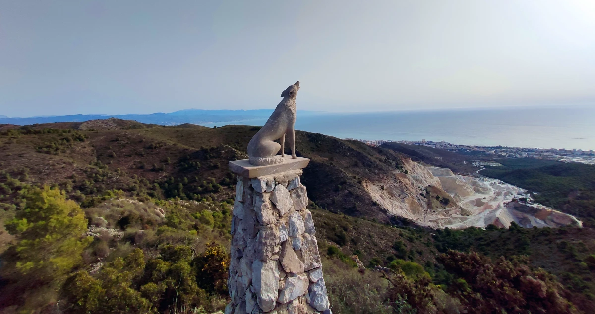
Cañada del Lobo
The Cañada del Lobo route is one of the most popular paths (and crowded by bicycles) in the province of Malaga.
This route offers one of the best views of both Malaga capital, the Costa del Sol, the P.N. Sierra Tejeda, Almijara and Alhama, Sierra de Camarolos, the nearby Jabalcuza peak or La Maroma , highest point in the province.
The beauty of the path to the Cañada del Lobo is that it combines sections of cement, with fine sandy terrain, dirt and even a small section of forest track.
Details of the Cañada del Lobo route
- Google Maps start point: Start Local trail R1
- Distance: 11 km.
- Maximum altitude: 710 meters
- Time spent: 2h 30 minutes (2h 10min active + 20min rest).
- Ideal time: September-June.
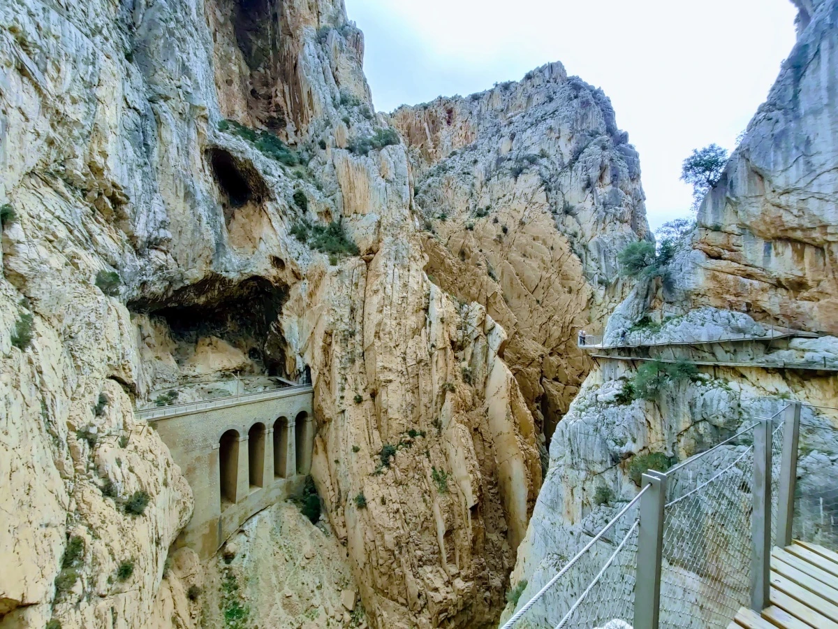
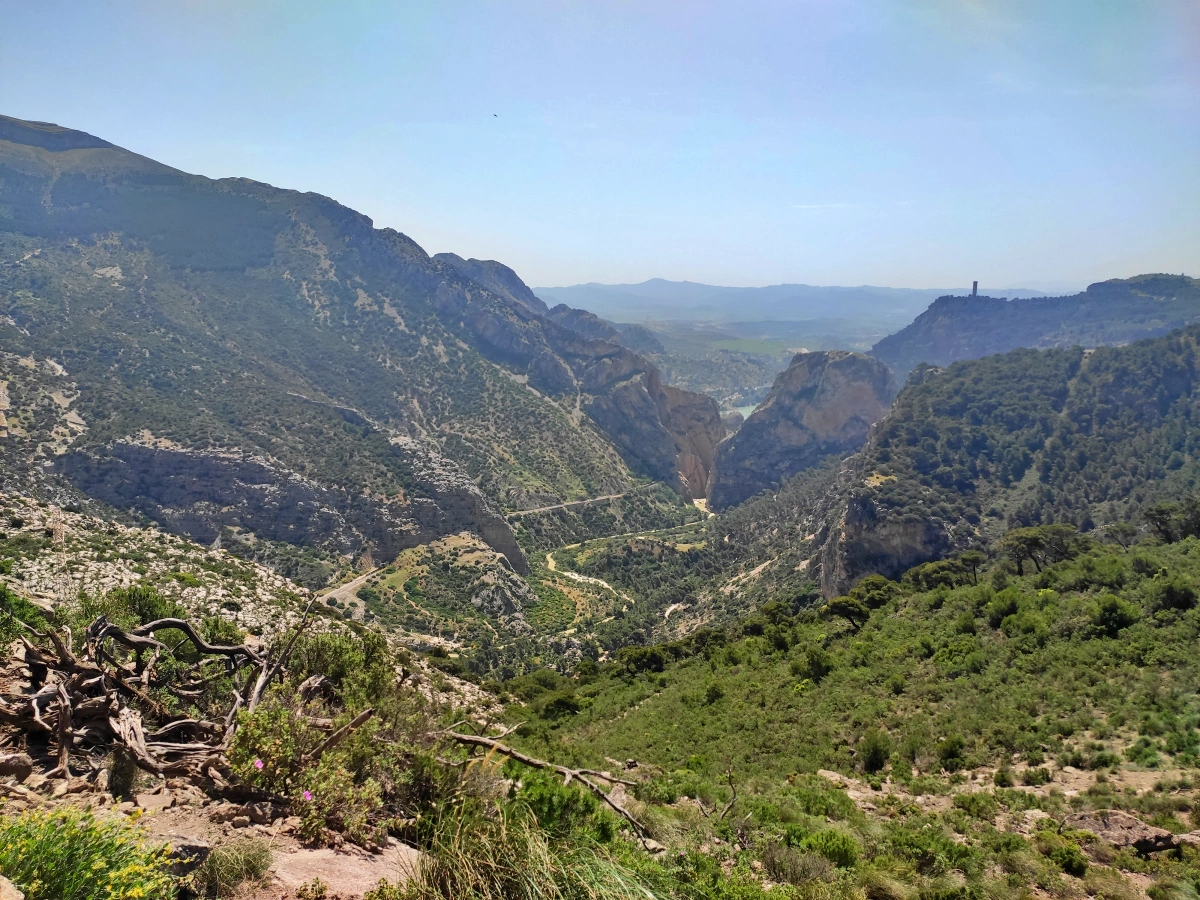
Caminiot del Rey (King’s Path)
El Caminito del Rey is the most important attraction in the province of Malaga and an essential for Malaga residents and for visits of more than one day to the city.
El Caminito del Rey is 7.7 kilometers long, with the walkways part (the most beautiful and well-known) being 2.9 km , controlled by an access that requires input.
The part of the Caminito del Rey that requires an entrance runs along some walkways (wooden) attached to the rock inside a canyon, with sections barely a meter wide, hanging up to 105 meters above the river, on walls that are vertical.
Information on the Caminito del Rey.
- Google Maps starting point: Parking King’s Path.
- Distance: 7.7 km.
- Time spent: 3-4 hours
- Ideal time: all year round.
You have all the information about the Caminito del Rey in our guide.
5 difficult level hiking trails in Malaga province
Here I include the hiking routes that require a good physical shape and have some experience in mountain routes. In all of them we will have to overcome certain powerful slopes, face some technical areas and apply the sense of orientation.
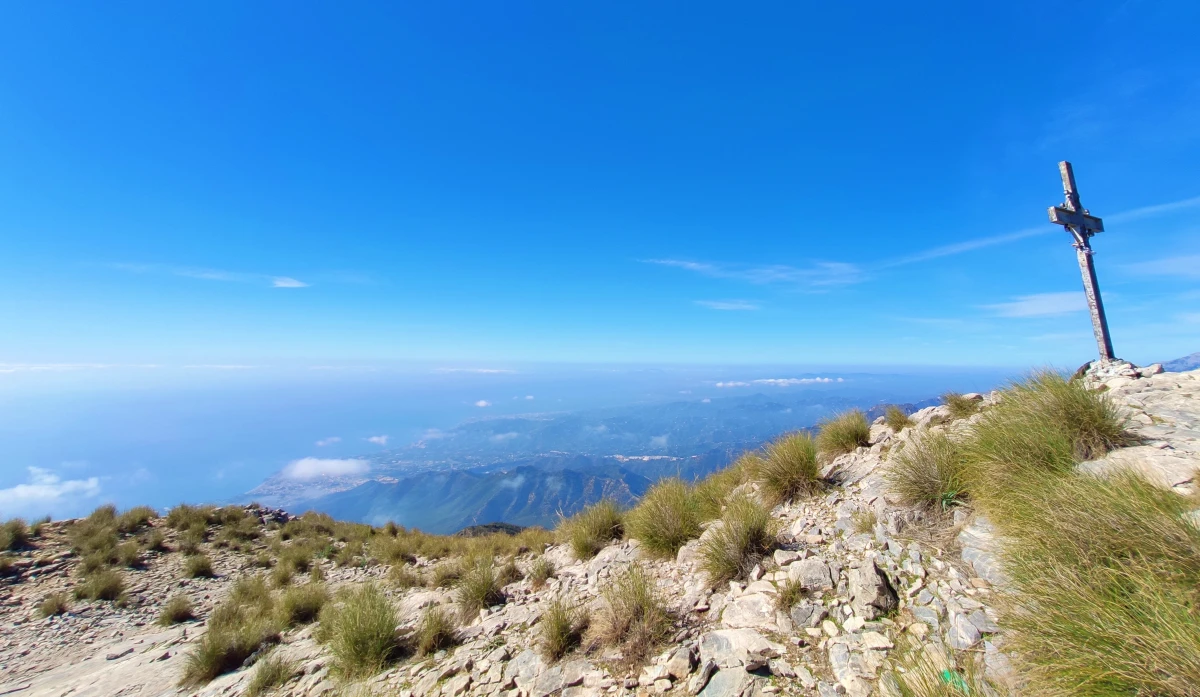
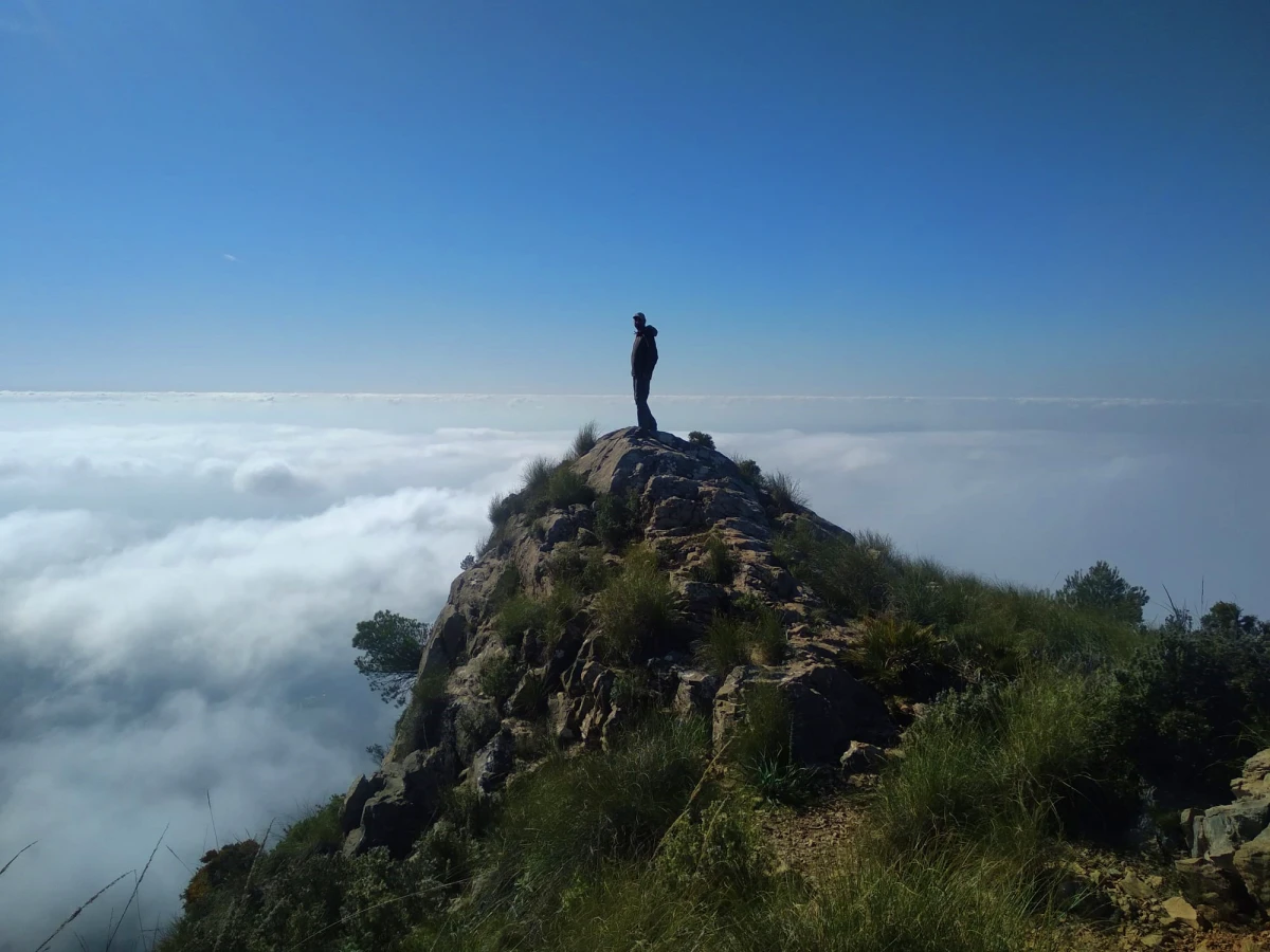
Ascent to the Peak of Heaven (Pico del Cielo)
The climb to Pico del Cielo is a hiking route that is both demanding and beautiful, being one of the most complete in the entire province of Málaga.
Its summit rises 1,508 meters above sea level and allows us to contemplate the entire mountainous axis of the Sierras de Tejera and Almijara, even on sunny days. Sierra Nevada, the Mediterranean Sea and the African coast can be seen with great visibility.
The type of path is a dirt path, to then pass through rocky, clayey terrain and ending with a section of loose rocks, in which we must exercise extreme caution.</p >
Information on the climb to Pico del Cielo.
- Google Maps starting point: El Pinarillo recreational area.
- Total length: 14 km (beginning and ending in the Pinarillo recreational area).
- Maximum elevation: 1,500 meters.
- Ideal time: September-November and March-June.
La Bola de Mijas.
The ascent to Pico de Mijas (Bola de Mijas) 1150 meters high is one of the most interesting hiking routes that can be done in Malaga .
In this case, the route requires a good physical condition, both for duration (more than 4h), distance (15 km) and for the unevenness that is overcome. In addition, we reached 1,139 meters above sea level, starting at just 339 meters.
La Bola de Mijas gets its name from the station of the State Meteorological Agency (AEMET) with a spherical shape at its top (1150 meters). It is located between the municipalities of Mijas and Alhaurín El Grande, north of the urban center of Mijas.
Data of the Climb to the Mijas Ball.
- Google Maps starting point: “Source Del Acebuche Trail”
- Distance: 15.10 km.
- Total height difference: 1752 meters (876m + 876m).
- Maximum altitude: 1,139 meters
- Time spent: 4h 21min (3h 40min active + 40min breaks).
Sendero de los Presidiarios (Convicts Path).
The climb to Monte de las Tres Caleras, the end point of the Prisoners Trail, stands out for its hardness (despite its short route), its scenic beauty and its variety of natural environments through which it passes.
A demanding route on the physical plane due to the unevenness that we will have to overcome, sometimes in a stair format of the land itself and others in slopes that can reach 20% slope.
It is highly recommended to bring trekking poles to speed up the ascent and to avoid falls on the descent.
Convict Path Data.
- Start point on Google Maps: Start of the Prisoners Trail.
- Distance: 8.40 km.
- Total drop: 1,180 meters (590m + 590m).
- Time spent: 4 hours (3h 40 min active + 20 min rest).
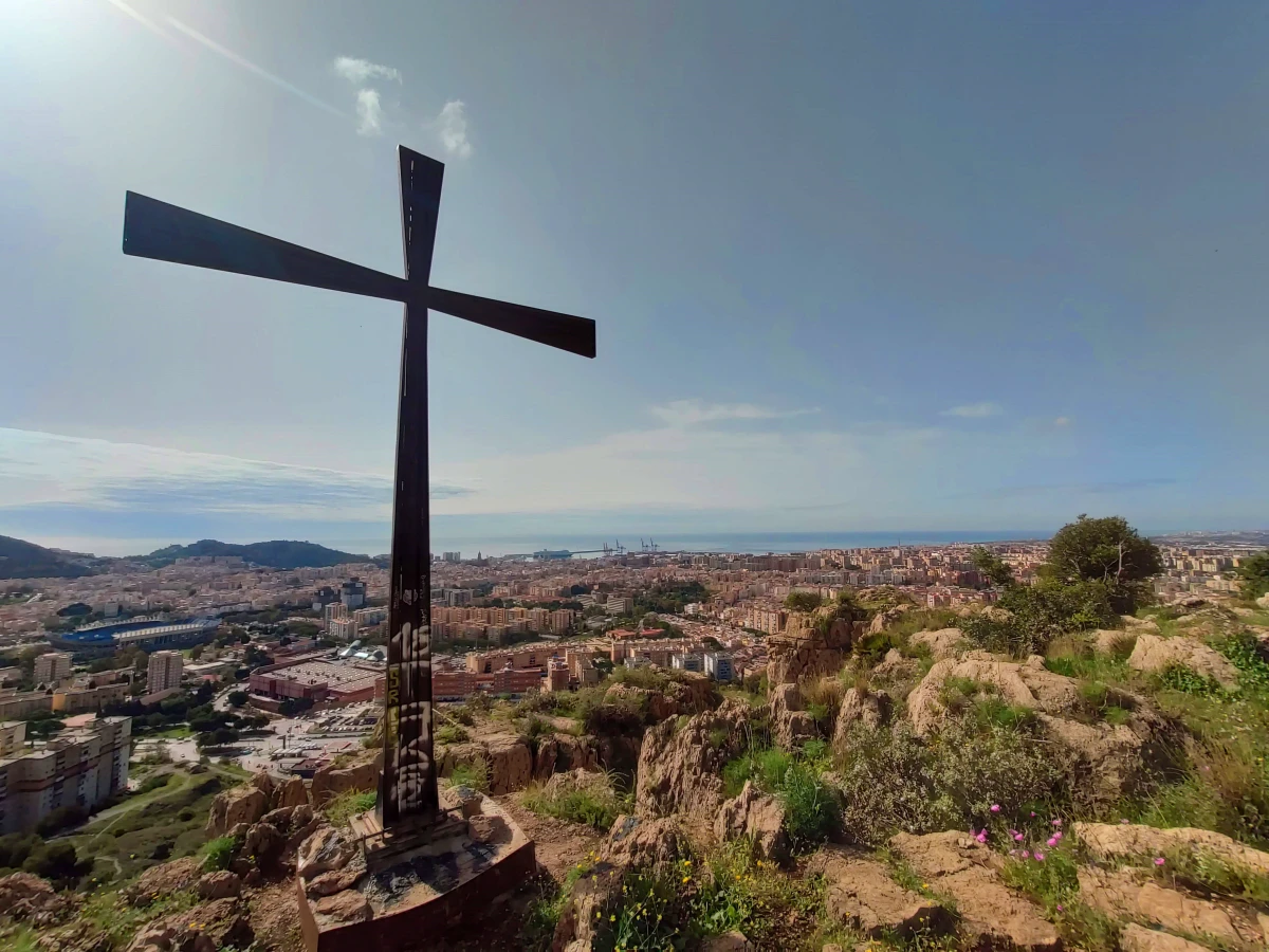
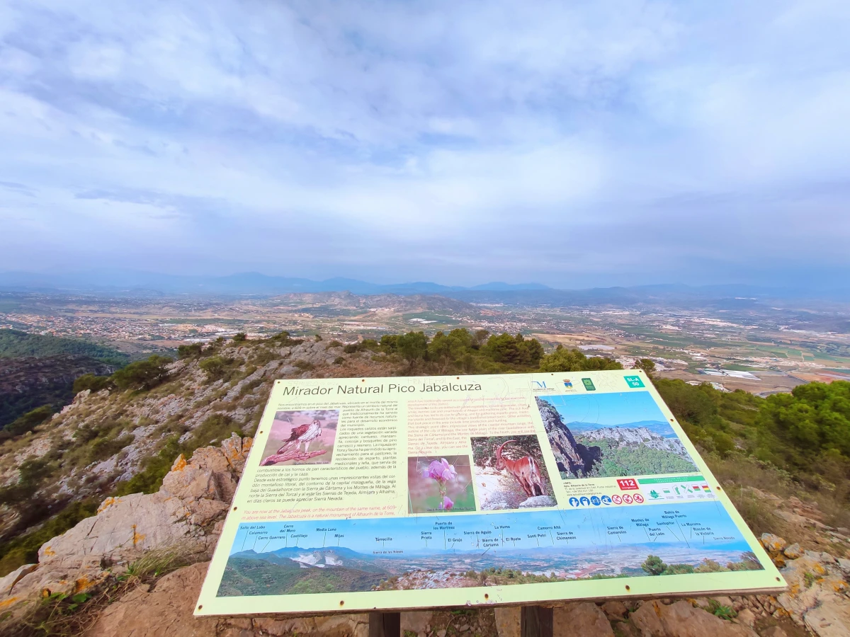
Ascent to Pico Jabalcuza.
The route up the Jabalcuza peak, 605 meters high, offers one of the best views of the province of Malaga thanks to its strategic location.
From its summit we will clearly see all the inland mountain systems, the capital, Malaga airport and, partially, the Costa del Sol.
The “problem” of the ascent to Jabalcuza lies in itshigh slope (more than 400 meters of positive slope) which makes it a field not suitable for all audiences, at least not for those facing a climb for the first time.
Data on the route of the Ascent to Jabalcuza
- Google Maps starting point: “Jabalcuza Trail”
- Distance: 6.40 km.
- Total drop: 848 meters (424m + 424m).
- Maximum altitude: 605 meters
- Time spent: 1h 48 min (1h 30 min active + 18 min rest).
- Ideal time: all year round.
Pico del Convento (Convent Peak).
The ascent to the Pico del Convento in El Chorro offers spectacular 360-degree views of the Conde de Guadalhorce, Gaitanejo, Guadalteba and Guadalhorce reservoirs, as well as the entire area of the famous Caminito del Rey.
The route taken to climb the Pico del Convento is 9 kilometers long, which can be easily completed in about 3 hours at a medium pace and with the corresponding breaks to hydrate and eat.
Data on the ascent to Pico del Convento.
- Google Maps starting point: “Gaitanejo Trail Parking”
- Distance: 9.23 km.
- Total drop: 822 meters (396 + 426m).
- Maximum altitude: 573 meters
- Time spent: 3 hours (2h 30 min active + 30 min rest).
- Ideal time: spring, autumn and early winter, being somewhat more demanding in summer, due to the high temperatures in the area.
Te puede interesar:

Holy Week in Malaga 2026: Dates, Processions, Routes…
GUIDE to MALAGA FAIR 2024
Christmas in Málaga 2025: Lights, Nativity Scenes…
Top 5 Best Flamenco Shows in Malaga
MALAGA CHRISTMAS Lights 2023: DATES and SCHEDULES
Christmas Lights in Málaga 2025 | Complete Guide,…
Christmas in Torremolinos 2025: Lighting Ceremony,…
Bus Malaga to Torremolinos (M-110): Schedules and Prices


: Schedules and Prices")
- Top 5 Best Flamenco Shows in Malaga - 1 June, 2023
- Christmas in Malaga 2022. What to do and see - 2 December, 2022
- Top 10 Restaurants in Malaga to eat recommended by a local - 18 November, 2022